Weather Routing is all about using real-time weather data to identify the most efficient and safest route for a ship’s journey. Rather than simply opting for the shortest path, this technology takes into account weather forecasts, ship characteristics, and cargo requirements to help vessels avoid severe weather, optimise fuel consumption, and ensure the crew’s safety. By continuously monitoring fuel use, emissions, and speed predictions, weather routing enables shipping companies to make better, real-time decisions that enhance both operational efficiency and sustainability. The benefits are clear: significant fuel savings (ranging from 3% to 10%), reduced operating costs, fewer delays, and a strong contribution to achieving decarbonisation goals. Weather routing isn’t just about improving your bottom line—it’s about navigating smarter and greener, with long-term benefits for both business and the environment.
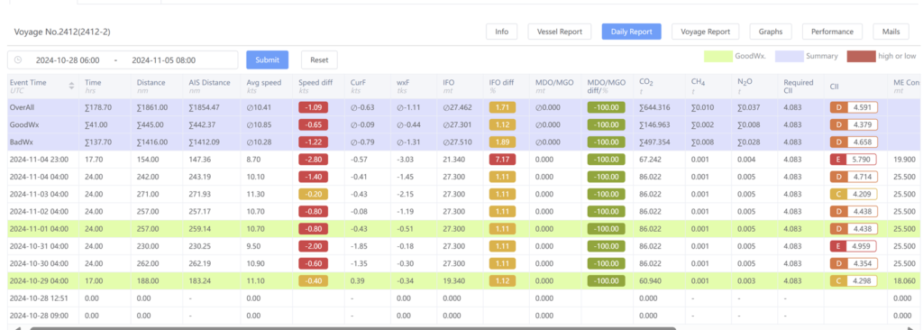
1. Good/Bad Weather Ship Operation Data Analysis
- Count of days with good and bad weather conditions
- Impact of currents waves, and wind on vessel speed
- Daily monitoring of fuel consumption and vessel speed
- Daily carbon emission monitoring
- Daily calculation of the CII (Carbon Intensity Indicator) rating

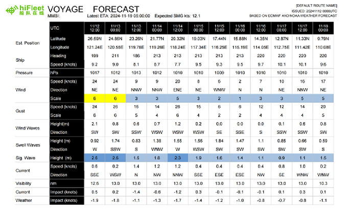
2. Weather Reports Along Route Plan
- 6-day weather forecast for the ship’s planned route
- Predict vessel speed based on water currents and weather conditions
- Provide updated weather forecasts to ships 1 to 4 times daily, as needed


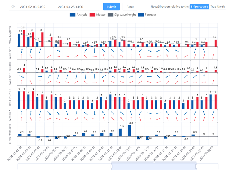
- Graphical comparison of wind, wave, swell, and ocean currents data
- Display the relative bearing between wind, waves, and the ship’s heading (or northward direction)

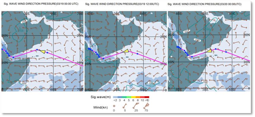
- Optimise routes to achieve energy savings and reduce emissions
- Show the percentage of energy savings and compare the remaining distance/time with the original route
- Compare surf-riding, broaching-to, successive high-wave impacts, synchronous rolling, and parametric rolling between the original and optimised routes
- One-click download of optimised waypoints for ship reference


